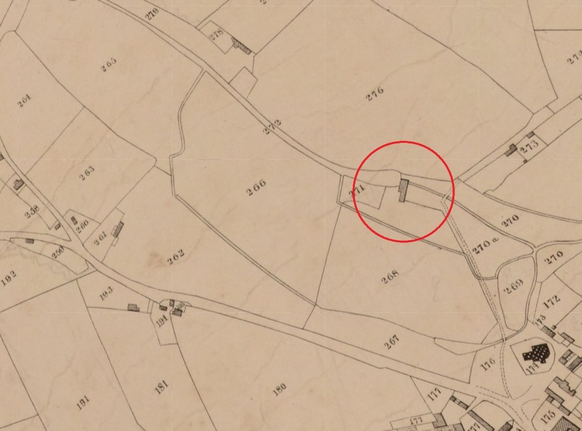
The Tithe map of 1840 showing the mill circled in red and the mill pond upsteam from that. Note the stream overflow going around field 266 and down what is now Marlbourough Road, infront of St Margaret’s Church (1740 before rejoining the stream.

The Tithe map of 1840 showing the mill circled in red and the mill pond upsteam from that. Note the stream overflow going around field 266 and down what is now Marlbourough Road, infront of St Margaret’s Church (1740 before rejoining the stream.
